Interior of the planets

Post requests, images, descriptions and reports about work in progress here.
Avatar
Cham M
Posts: 4324
Joined: 14.01.2004
Age: 60
With us: 20 years 10 months
Location: Montreal

Post #41by Cham » 11.04.2007, 23:17

Aphyle2007 wrote:On a related note, it might be useful to label the static model (as you have shown) on one side, and a dynamic model (lithosphere, asthenosphere, etc.) on the other side.

Question - could one model vertical convection? Descending subducted plates? It would be cool to combine the magnetic Earth model with convection cells in the outer core. Not that I have any idea how to do this, but it would be cool for geologists and Earth science teachers.


The idea to have another truncation on the other side is interesting.

I already experimented the convection. It can work. However, I was experiencing some troubles with depth sorting of the convection planes, so I'm not sure I could achieve a satisfying effect.

There's a possibility to merge my magnetic field lines with the Earth model. I'm still not convinced it will give a good result. I suspect it will be messy and confusing, all in 3D.

I was also thinking about lithosphere details (subduction, continental thickness, etc). This is much harder to do, and will raise considerably the number of polygons. But the idea is still playing with my mind :wink:
"Well! I've often seen a cat without a grin", thought Alice; "but a grin without a cat! It's the most curious thing I ever saw in all my life!"

Aphyle2007
Posts: 49
Joined: 19.03.2007
With us: 17 years 8 months
Location: Virginia

Post #42by Aphyle2007 » 12.04.2007, 02:57

Cham wrote:The idea to have another truncation on the other side is interesting.

I already experimented the convection. It can work. However, I was experiencing some troubles with depth sorting of the convection planes, so I'm not sure I could achieve a satisfying effect.

There's a possibility to merge my magnetic field lines with the Earth model. I'm still not convinced it will give a good result. I suspect it will be messy and confusing, all in 3D.

I was also thinking about lithosphere details (subduction, continental thickness, etc). This is much harder to do, and will raise considerably the number of polygons. But the idea is still playing with my mind :wink:


Thanks for the reply. It is gratifying to see that someone has at least tried the vertical dimension. I'd love to take a look.

I've got a colleague with whom we have developed some rather detailed plate tectonic cross-sections for instructional purposes, but the details could be rendered in polygons rather easily, I would (naively) think. Can you give me some details on the limits to the number of polygons? I just need a little info in the parameter department.

Eric

Avatar
Cham M
Posts: 4324
Joined: 14.01.2004
Age: 60
With us: 20 years 10 months
Location: Montreal

Post #43by Cham » 12.04.2007, 03:07

Aphyle2007 wrote:Can you give me some details on the limits to the number of polygons? I just need a little info in the parameter department.


With the 3ds format, each piece must have less than about 65000 triangles. It's a limitation of the 3ds format, not of Celestia. The entire model should have, say, less than 500000 (half a million) triangles, to have a smooth frame rate in Celestia on most (?) computers. For example : my truncated Earth has a bit less than 103000 triangles.
"Well! I've often seen a cat without a grin", thought Alice; "but a grin without a cat! It's the most curious thing I ever saw in all my life!"

Avatar
Topic author
Fenerit M
Posts: 1880
Joined: 26.03.2007
Age: 17
With us: 17 years 7 months
Location: Thyrrenian sea

Post #44by Fenerit » 12.04.2007, 18:37

These high end's ideas are what I've hoped that should happen. My surprise of a lack of interior structures in Celestia seem that has been filled with success. Vulcanism too, could be represented with a cross-section. Aphyle2007, what do you think about the book of Don Anderson "Theory of Earth" and expecially of the data there collected? Because this book is the thing most straigthforward that I've on the subject. I'm not familiar with the book of R. Fortey, but if you should can give to us some standard values or rectify that extants, you may know that with a politic of menu's altsurface map we can change the data; e.a, to choice between an altsurface map of the dinamic model, an altsurface map of molecules, crystal lattice, seismic waves etc. and this even for the cross sections models.

Aphyle2007
Posts: 49
Joined: 19.03.2007
With us: 17 years 8 months
Location: Virginia

Post #45by Aphyle2007 » 13.04.2007, 03:37

Fenerit wrote: what do you think about the book of Don Anderson "Theory of Earth" and expecially of the data there collected? Because this book is the thing most straigthforward that I've on the subject. I'm not familiar with the book of R. Fortey, but if you should can give to us some standard values or rectify that extants, you may know that with a politic of menu's altsurface map we can change the data; e.a, to choice between an altsurface map of the dinamic model, an altsurface map of molecules, crystal lattice, seismic waves etc. and this even for the cross sections models.


I've not look extensively at the Anderson book, but I know there is a copy or two in my department - I will borrow a copy.

I REALLY like the AltSurface idea - I was not sure that it was possible in your model, but it seems that it is. Let me work up the parameters for a few of these AltSurfaces and shoot them your way.

BTW - we had a seminar today from a geophysicist who works with an international ocean drilling program, showing a new model for oceanic lithospheric material that is non-homogenous. When I can get a copy of her presentation, I will send a couple of images along. What this brought to mind is a question if a CTX could be defined to give hires textures for at least the crust, especially showing the difference between continental and oceanic lithosphere. Thoughts?

Eric

CurlSnout
Posts: 27
Joined: 06.01.2006
With us: 18 years 10 months
Location: Pacific NW USA

Post #46by CurlSnout » 13.04.2007, 21:04

This is a WONDERFUL add-on.

Can I ask, which surface textures for Earth are used here? I don't have any that show such nice bathymetry.

Thanks for all your work,

cs

Avatar
Cham M
Posts: 4324
Joined: 14.01.2004
Age: 60
With us: 20 years 10 months
Location: Montreal

Post #47by Cham » 13.04.2007, 21:23

CurlSnout wrote:Can I ask, which surface textures for Earth are used here? I don't have any that show such nice bathymetry.


Actually, I don't remember where I got this texture. However, I know it's a pretty "standard" texture published a long time ago by some Celestia user. I personnaly have several very nice high resolution (4k and 8k) bathymetry textures like this one.

Remember that not all good textures have been published on the Motherlode. You'll have to search the net about Celestia textures.
"Well! I've often seen a cat without a grin", thought Alice; "but a grin without a cat! It's the most curious thing I ever saw in all my life!"

Avatar
Topic author
Fenerit M
Posts: 1880
Joined: 26.03.2007
Age: 17
With us: 17 years 7 months
Location: Thyrrenian sea

Post #48by Fenerit » 15.04.2007, 16:53

As an example of Altsurface idea see below the seismic tomography, whose map display herself after a right click inside the break (not in the crust sphere because this is reserved to the choice of the alternative Earth's maps).

http://shutter02.pictures.aol.com/data/ ... zi0300.jpg

For CTX question, in this moment is not a feature supported by 3d meshes but only by the default Celestia's spheroid which are inalterable with an external 3d program. Future version of the program perhaps will do this, I should hope willingly. For details about the crust I've some idea how to do this and when my solution is ready I shall post a screenshot here. (note, I have already some data of the oceanic lithosphere as well as the asthenosphere, but of 1991, so, if you new data arrive to me during the development are welcomed and I shall make the model in corformity with these, else I shall replace the screenshot's data with yours successively).

Another thing; the cross section about whatever one whish to show, it can be displaced around the model as "spacecraft", whose user's choice follow the way of the normal Celestia's spacecraft, in this manner the high resolution of the cross sections to be preserve.

Aphyle2007
Posts: 49
Joined: 19.03.2007
With us: 17 years 8 months
Location: Virginia

Post #49by Aphyle2007 » 15.04.2007, 22:29

Fenerit wrote:... if you new data arrive to me during the development are welcomed and I shall make the model in corformity with these, else I shall replace the screenshot's data with yours successively).

Another thing; the cross section about whatever one whish to show, it can be displaced around the model as "spacecraft", whose user's choice follow the way of the normal Celestia's spacecraft, in this manner the high resolution of the cross sections to be preserve.


As soon as I get the graphics from the presenter, I will also get her permission to incorporate them into the model. All credit should be given and referenced.

I see how the "spacecraft" mode might be used. I used the Mars Volcanoes models for the Hires Mars, and the effect is pretty cool, especially when I use Martian geology textures. So I see how a subducting plate as well as a hot-spot could be rendered in this fashion. This is a good excuse as any to work on modeling. Great idea! Thanks!

And again, I like the alternative texture idea, so let me work up some prospective data for you.

Regards,
Eric

Avatar
Cham M
Posts: 4324
Joined: 14.01.2004
Age: 60
With us: 20 years 10 months
Location: Montreal

Post #50by Cham » 18.04.2007, 01:08

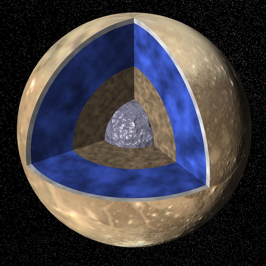
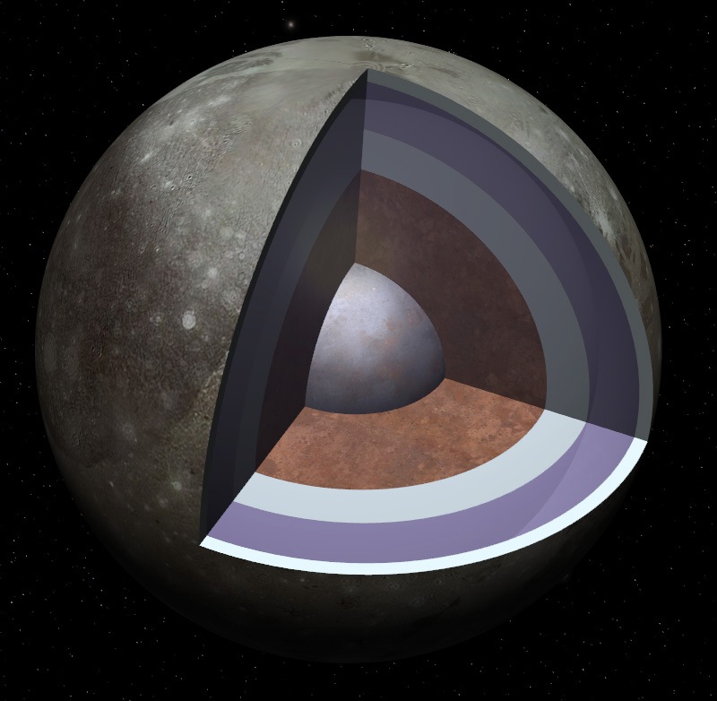
I'm very tempted to make a model of Ganymede and Europa, according to the following sites :

http://en.wikipedia.org/wiki/Ganymede_(moon)

http://en.wikipedia.org/wiki/Europa_(moon)

http://www.xtec.es/recursos/astronom/ga ... /coree.htm

http://www.solarviews.com/cap/jup/eurint.htm

The possibility for an internal global liquid water ocean is very fascinating. The only problem I'm facing are the relative depth of each layer, chemical composition, temperature, etc. I need reliable info on this, for the model to be really usefull.
"Well! I've often seen a cat without a grin", thought Alice; "but a grin without a cat! It's the most curious thing I ever saw in all my life!"

Avatar
Adirondack M
Posts: 528
Joined: 01.03.2004
With us: 20 years 8 months

Post #51by Adirondack » 18.04.2007, 11:17

Hi Cham,

I found little typos in your Earth structure addon:
Gutenberg instead of Gutemberg (N, not M).
Correctly it is named as "Wiechert-Gutenberg-discontinuity" (border of core and mantle).
Well, and Mohorovicic has to be Mohorovi[b]?
We all live under the same sky, but we do not have the same horizon. (K. Adenauer)
The horizon of some people is a circle with the radius zero - and they call it their point of view. (A. Einstein)

Avatar
Cham M
Posts: 4324
Joined: 14.01.2004
Age: 60
With us: 20 years 10 months
Location: Montreal

Post #52by Cham » 18.04.2007, 16:20

Adirondack,

there's no typo in Gutenberg. For example, see that link :

http://en.wikipedia.org/wiki/Image:Slice_earth.svg

In all documentations I've seen on the net, it is spelled that way. In some rare cases, I also saw Gutemberg. Apparently, both ways are possible. And please, read again your own post : you used an "n" too !

Same case for Mohorovicic.
"Well! I've often seen a cat without a grin", thought Alice; "but a grin without a cat! It's the most curious thing I ever saw in all my life!"

Avatar
t00fri
Developer
Posts: 8772
Joined: 29.03.2002
Age: 22
With us: 22 years 7 months
Location: Hamburg, Germany

Post #53by t00fri » 18.04.2007, 17:21

Cham wrote:Adirondack,

there's no typo in Gutenberg. For example, see that link :

http://en.wikipedia.org/wiki/Image:Slice_earth.svg

In all documentations I've seen on the net, it is spelled that way. In some rare cases, I also saw Gutemberg. Apparently, both ways are possible. And please, read again your own post : you used an "n" too !

Same case for Mohorovicic.


Of course, Cham...

Wow, our German "experts"...have a look

http://www.uni-mainz.de/universitaet/50.php

Bye Fridger
Image

Avatar
Cham M
Posts: 4324
Joined: 14.01.2004
Age: 60
With us: 20 years 10 months
Location: Montreal

Post #54by Cham » 18.04.2007, 18:44

Here's what I may try to reproduce for Celestia (Ganymede in this case). However, I also want to add some text on the model, or else it will be boring to look at. I just don't know what to add, since there isn't any reliable information for the inside. Any suggestion ?

Image

Image
"Well! I've often seen a cat without a grin", thought Alice; "but a grin without a cat! It's the most curious thing I ever saw in all my life!"

Avatar
Cham M
Posts: 4324
Joined: 14.01.2004
Age: 60
With us: 20 years 10 months
Location: Montreal

Post #55by Cham » 18.04.2007, 19:31

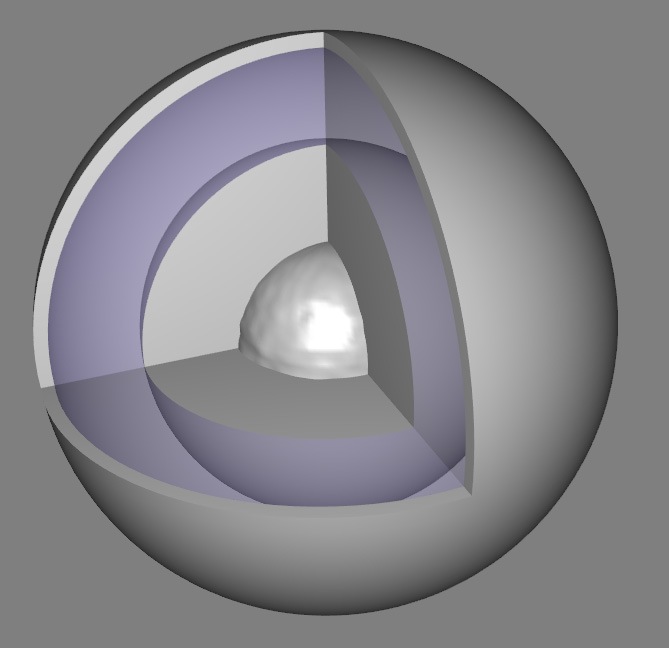
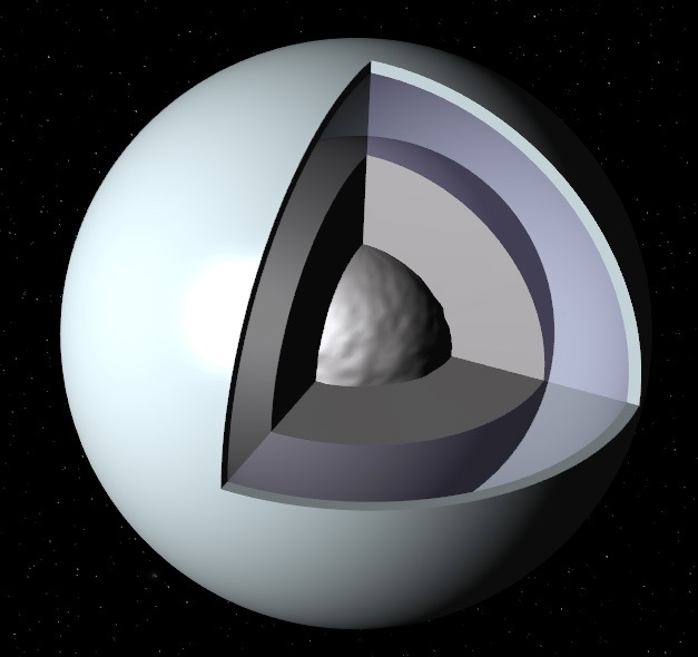
Here's a prototype model of Ganymede. I'm wondering if I should simulate the water filling with that gap between the inner mantle and the ice crust, with some fading out effect inside the water (transparent textures). Opinion, please ?

Image

EDIT : Here's a nice view, by the way (from this web site : http://solarsystem.dlr.de/TP/aufbau_en.shtml ) :

Image
"Well! I've often seen a cat without a grin", thought Alice; "but a grin without a cat! It's the most curious thing I ever saw in all my life!"

Don. Edwards
Posts: 1510
Joined: 07.09.2002
Age: 59
With us: 22 years 2 months
Location: Albany, Oregon

Post #56by Don. Edwards » 18.04.2007, 20:21

Cham,

This is a fanastic idea. I believe there is also a cutaway like this showing the layers of Jupiter as well. I will see if I can find the link for you.

Don. Edwards
I am officially a retired member.
I might answer a PM or a post if its relevant to something.

Ah, never say never!!
Past texture releases, Hmm let me think about it

Thanks for your understanding.

Avatar
Cham M
Posts: 4324
Joined: 14.01.2004
Age: 60
With us: 20 years 10 months
Location: Montreal

Post #57by Cham » 18.04.2007, 20:45

A peach in space. The prototype is behaving very well in Celestia. I'm just not sure yet of the transparent parts. It's looking weird :

Image
"Well! I've often seen a cat without a grin", thought Alice; "but a grin without a cat! It's the most curious thing I ever saw in all my life!"

ajtribick
Developer
Posts: 1855
Joined: 11.08.2003
With us: 21 years 3 months

Post #58by ajtribick » 18.04.2007, 21:25

Hmm... where's the Evil Dr. when you need him, eh?

I don't think you'd get a water ocean as deep as is suggested on those diagrams - at some point the pressure gets to the point where it is possible to form high-pressure ice. So resorting to ADS...

This paper on magnetic field of Ganymede (pdf) references a 1982 paper (pre-Galileo!) which suggests an ocean sandwiched between ice layers at around 170-250 km below the surface (Ice I above, Ice V below).

This abstract gives a metallic (iron or iron sulphide) core radius of 400-1300 km, and an ice shell thickness of 800 km, between which is the silicate mantle.

This paper has models of the interior structure which do not include an ocean, instead there are various ice phases through the shell: ice I, ice III, ice V, ice VI. Based on measurements of the graph of density transitions, the depths of the base of each shell are at about 180, 240, 370 and 870 km (below which is the silicate mantle). Note that the ice III shell is pretty much where the ocean would be (from what I've been able to tell, if you get an ocean, you don't get ice III).

Avatar
Cham M
Posts: 4324
Joined: 14.01.2004
Age: 60
With us: 20 years 10 months
Location: Montreal

Post #59by Cham » 18.04.2007, 21:32

Yes, I'm also very sceptical about the global ocean of liquid water. But think about Enceladus, which is apparently containing liquid water inside. I know this is a very complex subject, related to tidal forces, pressure, etc... I'm not sure that my project is making any sense. :?

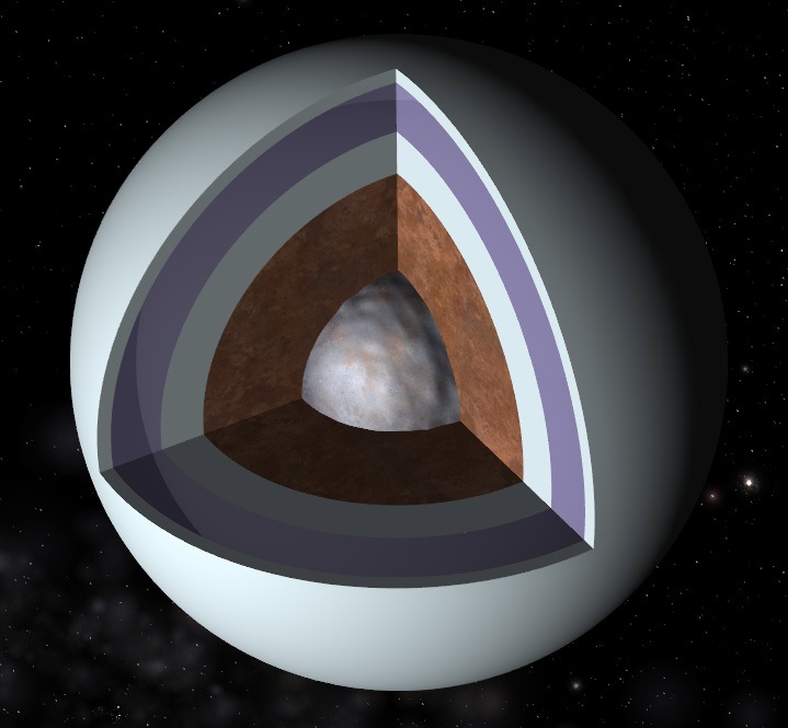
EDIT : I think it's better to make some compromises, by adding an inner ice layer :

Image

I'll add some text info, making it clear that all these layers are highly hypothetical.
"Well! I've often seen a cat without a grin", thought Alice; "but a grin without a cat! It's the most curious thing I ever saw in all my life!"

Avatar
Cham M
Posts: 4324
Joined: 14.01.2004
Age: 60
With us: 20 years 10 months
Location: Montreal

Post #60by Cham » 18.04.2007, 23:58

Here's an evolution of the model. Not finished, of course. I'm not satisfied with the 4K texture of Ganymede I'm using on the model (actually, a 8K texture reduced to 4K). It's good at some distance, but the details sucks at close range. The ice needs a good texture and I'm not sure about the rocky mantle. And what about the information to be shown ?

Image
"Well! I've often seen a cat without a grin", thought Alice; "but a grin without a cat! It's the most curious thing I ever saw in all my life!"


Return to “Add-on development”