
Please visit the Web page
http://www.lepp.cornell.edu/~seb/celest ... d.html#2.0
to see what's available.
I would *greatly* appreciate any feedback.

Selden, your update for 'tot-panorama-v3.zip' isn't clickable. The Philmont-topos seem ok, I'll have a look on them tomorrow. Jeamselden wrote:Please visit the Web page
http://www.lepp.cornell.edu/~seb/celest ... d.html#2.0
to see what's available.
Works fine now, thanks Selden. About Philmont, I tried a quick test on my poor machine, and have some strange things: locations seems under the map when I zoom in, and I see ugly black globes for them... (like the sign of an unreadable model, I guess)selden wrote:JeamTag,
Sorry, I must have made a typo when I uploaded it. It's fixed now. Please try again.
 How could they appear?Jeam
 Code: Select all
#celmodel__ascii
# invisible plane

material
texture0 "invisible.*"
diffuse 1 1 1 opacity 0.5 end_material
mesh
vertexdesc position f3 normal f3 texcoord0 f2 end_vertexdesc

vertices 4
0 0 0  0 1 0    0.999 0.001
0 0 1  0 1 0    0.001 0.001
1 0 1  0 1 0    0.001 0.999
1 0 0  0 1 0    0.999 0.999

trilist 0 6
0 1 2 2 3 0
end_mesh
You're right Selden, it depends of the POV: with the Cel://url sometimes the locations are visible, sometimes they are not.selden wrote:Labels under the models is a bug in Celestia. It does not draw the labels at the correct altitude if you are "too close". They should be visible if you start from the Cel://url in the HTML file and magnify your view.

 Jeam
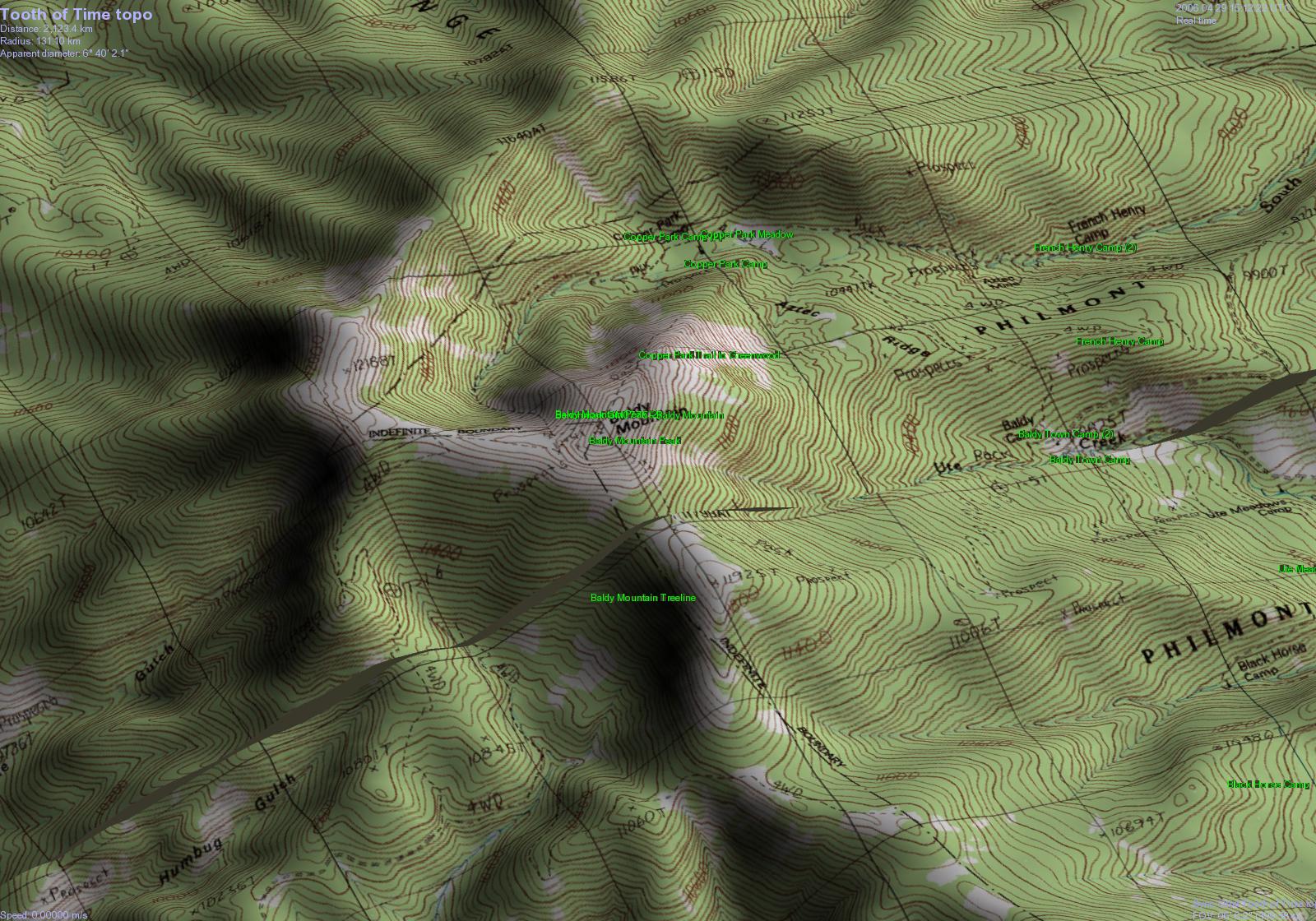
Jeam Well, Selden, I don't know if I not prefer the first fix with boards, finally: Here is what I have now on my poor machine:selden wrote:I've updated the 3D Philmont Addon to include a cube for the camps and a few other fixes.
 (same point of view as previous)
Yes, i saw that. There are the two problems: a discret mesh to point the site, and a better altitude location...selden wrote:Unfortunately, the bugs in how Celestia places Location lables, which can be turned off and on, forces the use of SSC objects, which are harder to hide when you don't want to see them. The visible cube could be made a small part of a larger invisible model, though. I'll try to do that. They need to be selectable objects, since their InfoURLs are an important part of the Addon.
Sorry for my poor English! I wanted to speak about the interstices between the tiles: If I Remember Correctly, in WorldWind (not installed on my computer for the moment) there were USGS data converted to be drawn even on the relief exaggerations, 'Sans solution de continuit?©' (I don't know what the English words are: that means that the map appears only one, even if it's made up of several pieces.).I'm not sure what you mean by maps that are "liable"

I agree, your work is already very good at this stage, Selden! I supposed the main goal was to site the scout camps, not to draw an invasion by amazing cubes from outer space! (1)Thanks for your efforts, this is a very interesting use of Celestia, IMHO.Jeamselden wrote:However, I think I've managed to do something reasonable about the display of camp models. I've changed the camp model to be a single point, disabled the Locations file, and written some scripts to turn markers and labels on and off.
