

it looks like it is back up FOR NOW
quoting the post over at CM
http://forum.celestialmatters.org/viewt ... ?f=9&t=616
you WILL need the "NmTools-2.0pre2" and "F-TexTools-2.0pre2"
http://forum.celestialmatters.org/viewt ... p?f=6&t=70
------------------------
Title : " GMTED 2010 ( 15&30 arcSec.) topo "
with the earth night map .It's time to update the SRTM2 /GTOPO30 map that is used in the "texture tools tutorial "
http://www.celestialmatters.org/?q=node/10
http://www.celestialmatters.org/users/t ... x2048..zip
and
http://snowy.arsc.alaska.edu/nasa/topog ... 200.bin.gz
However
the "Global Multi-resolution Terrain Elevation Data 2010 (GMTED2010)" is in ArcGIS database format
-- yes GDAL can convert it to a GTiff
but the ds15 is NOT a full map. Greenland is missing and it is
from NORTH 83.9998611
to SOUTH -56.0001389
the DS30 is also not a full map
NORTH 83.9998611
South -90 ( plus a bit for the 1/2 pixel )
so here is a 90 north 90 south 64k 16 bit signed LSB raw file to use
https://drive.google.com/file/d/0B6ZYAd ... sp=sharing
Ds15.zip is 854.6 MiB
ds15.65536_32768.16S.raw is 4 GiB
Every tone is 0.5 M
-844 to +17695
sea level is set at "0" zero
there is really no need to upload the 7 GiB 86400x43200 16 bit S raw
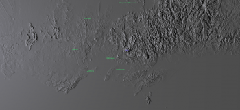

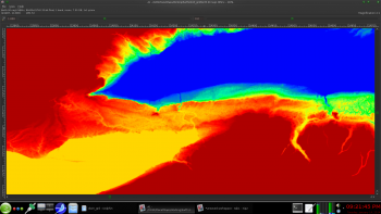
screenshots and a capture of the Niagara falls area ( false color )