IAU NAMES
Posted: 15.07.2008, 18:27
Real-time 3D visualization of space
https://celestiaproject.space/forum/
https://celestiaproject.space/forum/viewtopic.php?f=4&t=12636
chris wrote:...It would also be nice to create an alternate surface map for Titan using all the SAR images.
--Chris
t00fri wrote:chris wrote:...It would also be nice to create an alternate surface map for Titan using all the SAR images.
--Chris
Here I'd have strong reservations!
While radar imaging has high merits in combination with near IR imaging in the search for lakes, it is NOT a suitable tool for rendering the visual surface appearance of Titan! Since Celestia is UNFORTUNATELY still limited to rendering visual wavelength...
So that task would surely be for someone elseand would NOT have my endorsement...
chris wrote:t00fri wrote:chris wrote:...It would also be nice to create an alternate surface map for Titan using all the SAR images.
--Chris
Here I'd have strong reservations!
While radar imaging has high merits in combination with near IR imaging in the search for lakes, it is NOT a suitable tool for rendering the visual surface appearance of Titan! Since Celestia is UNFORTUNATELY still limited to rendering visual wavelength...
So that task would surely be for someone else
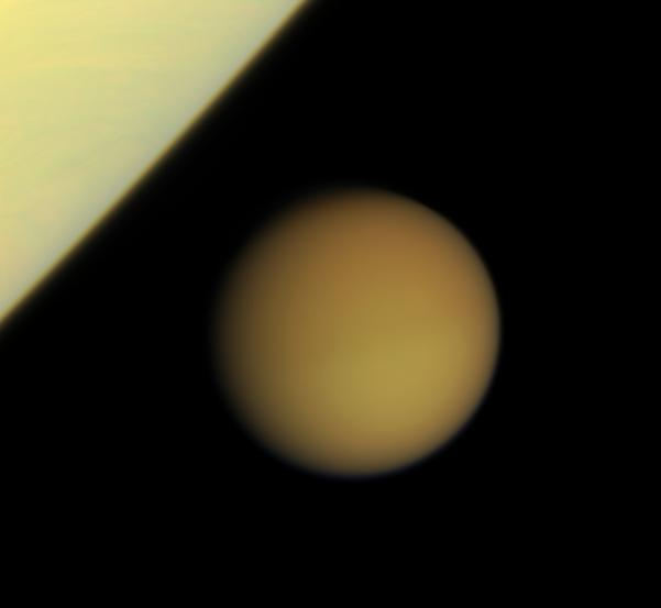
But it would certainly be appropriate to include it as an *alternate* surface, would it not? I am not proposing that we should replace the current map, only that we should add a second map selectable via the alternate surfaces context menu. There are many features that are only prominent in the radar imagery (lakes, candidate cryovolcanoes, impact craters.) It would be very educational to be able to switch between the IR map and the IR+RADAR map to see how the surface appears to different detectors.
Jason Perry has a created a nice Titan near-IR map with the SAR swaths overlain on it. All SAR swaths released so far on the PDS are included:
http://pirlwww.lpl.arizona.edu/~perry/RADAR/
--Chris
ElChristou wrote::D Time to implement filters?
Symaski62 is being typically telegraphic, so maybe I'm missing something ...chris wrote:Lots of new lakes named . . . It looks like we need to update the Titan locations.
ElChristou wrote::D Time to implement filters?
granthutchison wrote:Symaski62 is being typically telegraphic, so maybe I'm missing something ...chris wrote:Lots of new lakes named . . . It looks like we need to update the Titan locations.
But the lake names on his map date from September last year, and the mare and insula from April this year. They're all present in saturnmoon_locs.ssc as of April. My announcement of the lakes update is six months old, here.
I understand, was just that soon or later filters will have to be implemented, so as we need a reason to start, I thought it was perhaps a good one... (unfortunately I was wrong!chris wrote:I don't think that it's appropriate here...
Chris wrote:We simply want to give the user the choice of two different maps of Titan
No apologies necessary.chris wrote:My apologies, Grant. I'd forgotten about this and thought that the only named (apparent) liquid features on Titan were Kraken Mare and Ontario Lacus.
selden wrote:As best I can tell, WWT does not have wavelength filters. It just lets you select different named datasets. For example, select 2MASS [not WMAP as I typed previously] to see the sky in infrared. Am I overlooking something?
Of course, Celestia already does this for SSC objects using AltSurface, as Chris pointed out above.
If the Viewable operator were implemented for STC and DSC objects, this type of selection could be done for deep space objects, too.
Indeed...Hungry4info wrote:Um... of curiosity, if Celestia is to only display visible light wavelengths, what should we use for the maps of Titan and Venus? Don't both of their maps rely on radar wavelength data?
Hungry4info wrote:Um... of curiosity, if Celestia is to only display visible light wavelengths, what should we use for the maps of Titan and Venus? Don't both of their maps rely on radar wavelength data?

Yes, that's what I meant to say.BobHegwood wrote:All of these renditions are still trying to follow the inherent Celestia philosophy are they not?
It's just that we still lack reliable data for some of these objects. Yes? As long as the aim is to get to what is as realistic as possible, then I'm happy.
Right now, Venus is my own personal pain in the Wazoo because, although it has been demonstrated that there are gray portions of the surface (as seen from reprocessed Venusian lander images)
I can also point you to reputable scientific sites which describe the surface of the planet as being ("brown and reddish") in color. How does one choose the appropriate conditions for rendering in Celestia
when even the so-called "experts" disagree with each other concerning what the human eye would see? This is really perplexing, at least to me. Also, no one can tell me what effect the Venusian atmosphere has on our perceptions of the planet's surface.
However, as long as a good-faith effort is maintained to get to the bottom of these things, I am very happy with Celestia's approach to the rendering of the planets and moons. I must say that here, I agree
completely with the Good Doctor Schrempp, and his philosophies. He, at least, has the scientific background and knowledge in order to make educated decisions as to what the planets should look like.
Also, he is completely honest, and I think that this quality (more than any other) should be encouraged.